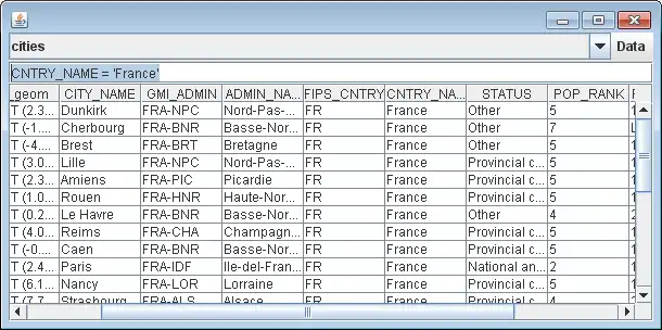
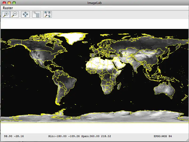
This is the Linux app named GeoTools, the Java GIS toolkit to run in Linux online whose latest release can be downloaded as geotools-20.2-bin.zip. It can be run online in the free hosting provider OnWorks for workstations.
Download and run online this app named GeoTools, the Java GIS toolkit to run in Linux online with OnWorks for free.
Follow these instructions in order to run this app:
- 1. Downloaded this application in your PC.
- 2. Enter in our file manager https://www.onworks.net/myfiles.php?username=XXXXX with the username that you want.
- 3. Upload this application in such filemanager.
- 4. Start the OnWorks Linux online or Windows online emulator or MACOS online emulator from this website.
- 5. From the OnWorks Linux OS you have just started, goto our file manager https://www.onworks.net/myfiles.php?username=XXXXX with the username that you want.
- 6. Download the application, install it and run it.
SCREENSHOTS
Ad
GeoTools, the Java GIS toolkit to run in Linux online
DESCRIPTION
GeoTools is an open source (LGPL) Java code library which provides standards compliant methods for the manipulation of geospatial data.GeoTools is an Open Source Geospatial Foundation project.
The GeoTools library data structures are based on Open Geospatial Consortium (OGC) specifications.
Features
- Definition of interfaces for key spatial concepts and data structures
- Open plug-in system allowing additional formats. Plugins supplied for raster, database and geospatial file formats.
- Includes extensions provide additional capabilities using the spatial facilites of the core library. Extensions provide graph and networking support (for finding the shortest path), validation, a web map server client, bindings for xml parsing and encoding and style generation
- Clean data access API supporting feature access, transaction support and locking between threads
- Vector support for app-schema, arcsde, csv, dxf, edigeo, excel, geojson, org, property, shapefile, wfs
- Spatial Database Support db2, h2, mysql, oracle, postgis, spatialite, sqlserver
- Raster plugins for arcsde, arcgrid, geotiff, grassraster, gtopo30, image (JPEG, TIFF, GIF, PNG), imageio-ext-gdal, imagemoasaic, imagepyramid, JP2K, matlab
- Powerful schema assisted parsing technology using XML Schema to bind to Java objects.
- XML Bindings for parsing/encoding xsd-core (xml simple types), fes, filter, gml2, gml3, kml, ows, sld, wcs, wfs, wms, wps, vpf.
- Rendering engine configured with OGC Standard Style Layer Descriptor files. Renderer is stateless, allowing low memory use particularly useful in server-side environments.
- Referencing using ESPG Database
- OGC Standards Support SLD/SE,Simple Feature,Grid Coverage, Filter/CQL,WMS,WFS,WPS, KML
Audience
Science/Research, Developers, Other Audience
User interface
Java Swing, Java SWT, Project is a graphics toolkit
Programming Language
Java
Database Environment
Project is a database abstraction layer (API), HSQL, Oracle, MySQL, PostgreSQL (pgsql), IBM DB2
This is an application that can also be fetched from https://sourceforge.net/projects/geotools/. It has been hosted in OnWorks in order to be run online in an easiest way from one of our free Operative Systems.


